Rachold, Volker (2000): Discription of coastal shape at Bykovsky Peninsula [dataset]. PANGAEA, https://doi.org/10.1594/PANGAEA.58197, Supplement to: Rachold, Volker; Grigoriev, Mikhail N; Are, Felix; Solomon, Steven; Reimnitz, Erk; Kassens, Heidemarie; Antonow, A (2000): Coastal erosion vs. riverine sediment discharge in the Arctic Shelf Seas. International Journal of Earth Sciences, 89(3), 450-460, https://doi.org/10.1007/s005310000113
Always quote citation above when using data! You can download the citation in several formats below.
Published: 2000 (exact date unknown) • DOI registered: 2009-02-27
Abstract:
This article presents a comparison of sediment input by rivers and by coastal erosion into both the Laptev Sea and the Canadian Beaufort Sea (CBS). New data on coastal erosion in the Laptev Sea, which are based on field measurements and remote sensing information, and existing data on coastal erosion in the CBS as well as riverine sediment discharge into both the Laptev Sea and the CBS are included. Strong regional differences in the percentages of coastal erosion and riverine sediment supply are observed. The CBS is dominated by the riverine sediment discharge (64.45210**6 t/a) mainly of the Mackenzie River, which is the largest single source of sediments in the Arctic. Riverine sediment discharge into the Laptev Sea amounts to 24.10210**6 t/a, more than 70% of which are related to the Lena River. In comparison with the CBS, the Laptev Sea coast on average delivers approximately twice as much sediment mass per kilometer, a result of higher erosion rates due to higher cliffs and seasonal ice melting. In the Laptev Sea sediment input by coastal erosion (58.4210**6 t/a) is therefore more important than in the CBS and the ratio between riverine and coastal sediment input amounts to 0.4. Coastal erosion supplying 5.6210**6 t/a is less significant for the sediment budget of the CBS where riverine sediment discharge exceeds coastal sediment input by a factor of ca. 10.
Related to:
Rachold, Volker; Grigoriev, Mikhail N (2000): Russian-German Cooperation System Laptev Sea 2000: The Expedition LENA 1999. Berichte zur Polarforschung = Reports on Polar Research, 354, 1-269, https://doi.org/10.2312/BzP_0354_1_2000
Project(s):
Arctic Coastal Dynamics (ACD)
Coverage:
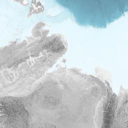
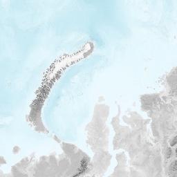
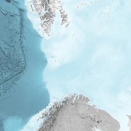
Latitude: 71.786120 * Longitude: 129.416970
Date/Time Start: 1982-01-01T00:00:00 * Date/Time End: 2000-12-31T00:00:00
Minimum Elevation: 25.0 m * Maximum Elevation: 40.0 m
Event(s):
Bykovsky_Peninsula_1982 * Latitude: 71.786120 * Longitude: 129.416970 * Date/Time Start: 1982-01-01T00:00:00 * Date/Time End: 2000-12-31T00:00:00 * Elevation Start: 25.0 m * Elevation End: 40.0 m * Recovery: 0.03 m * Location: Laptev Sea Coast, Russia * Campaign: ACD_Key_sites * Basis: Sampling on land * Method/Device: Coastal section (CSEC) * Comment: Silty sand - sandy silt with peat layers. Predominantly Late Pleistocene deposits/So-called Ice Complex, ice wedges and segregation ice, ice content 0.4-0.75, ground temperature -10 - -12 C/sedge, lichen, dwarf willow, moss, peat, arctic-tundra permafrost gley soils /Standard daily and monthly hydrometeorological data available since 1960 to 2000 (Tiksi Polar/Climate Station)/Tides 0.2 m, wind tides: up to 1 m, average wave height 0.4 m, sea water temperatures 0 - +5 C, currents: permanrnt along shore SE current/The key shore section of this site was investigated by quaternary geologists and geocryologists in detail. Average retreat rate of the coast is 2-2.5 m/year
Parameter(s):
| # | Name | Short Name | Unit | Principal Investigator | Method/Device | Comment |
|---|---|---|---|---|---|---|
| 1 | Date/Time of event | Date/Time | ||||
| 2 | Date/Time of event 2 | Date/Time 2 | ||||
| 3 | Elevation of event | Elevation | m | |||
| 4 | Elevation of event 2 | Elevation 2 | m | |||
| 5 | Onshore FORM-code | Onshore cd | Rachold, Volker | Visual observation | ||
| 6 | Distance to 10 m contour | Dist 10 m | m | Rachold, Volker | Visual observation | |
| 7 | Distance to 100 m contour | Dist 100 m | m | Rachold, Volker | Visual observation | |
| 8 | Distance to 500 m contour | Dist 500 m | m | Rachold, Volker | Visual observation | |
| 9 | Description | Description | Rachold, Volker | Visual observation | ||
| 10 | Backshore FORM-code | Backshore cd | Rachold, Volker | Visual observation | ||
| 11 | Shorezone complexity | Shorezone complexity | m | Rachold, Volker | Visual observation | |
| 12 | Frontshore FORM-code | Frontshore cd | Rachold, Volker | Visual observation | ||
| 13 | Offshore FORM-code | Offshore cd | Rachold, Volker | Visual observation | ||
| 14 | Distance to 2 m isobath | Dist 2 m isob | m | Rachold, Volker | Visual observation | |
| 15 | Distance to 10 m isobath | Dist 10 m isob | m | Rachold, Volker | Visual observation | |
| 16 | Distance to 20 m isobath | Dist 20 m isob | m | Rachold, Volker | Visual observation | |
| 17 | Distance to 100 m isobath | Dist 100 m isob | m | Rachold, Volker | Visual observation | |
| 18 | Unlithified-code | Unlithified-cd | Rachold, Volker | Visual observation | ||
| 19 | Ground-ice | Ground-ice | Rachold, Volker | Visual observation | ||
| 20 | Lithified-code | Lithified-cd | Rachold, Volker | Visual observation | ||
| 21 | Ice-code | Ice-cd | Rachold, Volker | Visual observation | ||
| 22 | Man-made structures | Man-made struc | Rachold, Volker | Visual observation |
License:
Creative Commons Attribution 3.0 Unported (CC-BY-3.0)
Size:
18 data points
Download Data
Datasets with similar metadata
- Grosse, G; Schirrmeister, L; Siegert, C et al. (2010): Age determinations from Bykovsky Peninsula, Siberia. https://doi.org/10.1594/PANGAEA.736033
- Wetterich, S; Schirrmeister, L; Pietrzeniuk, E (2005): Ostracods in permafrost deposits from the Bykovsky Peninsula 1998/1999. https://doi.org/10.1594/PANGAEA.879596
- Andreev, AA; Schirrmeister, L; Siegert, C et al. (2002): Pollen records of the Bykovsky Peninsula. https://doi.org/10.1594/PANGAEA.728522
Users interested in this dataset were also interested in
- Fischer, P; Happel, L; Anselm, N et al. (2022): Hydrographical time series data of Helgoland, Southern North Sea, 2013. https://doi.org/10.1594/PANGAEA.942205
- Pfalz, G; Diekmann, B; Freytag, J-C et al. (2022): Dating points for LANDO multi-core study. https://doi.org/10.1594/PANGAEA.945775
- Grosse, J; Endres, S; Engel, A (2020): Organic matter composition of the water column in mesocosm study (Svalbard 2010). https://doi.org/10.1594/PANGAEA.920945